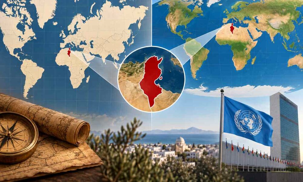
For generations, Tunisians have learned to view their country on world maps where Russia, Canada, Greenland or certain European regions occupy a spectacular visual presence. Tunisia has, however, never lost a single square kilometer: its area is 163 610 km². It is the map that changes our perception.
At issue: the Mercator projection, created in the 16th century and still very familiar in atlases, classrooms and digital representations. It enlarges surfaces progressively as one moves away from the equator. Tunisia is therefore itself enlarged, but much less than territories located farther north.
This question that is more than four centuries old has now taken on an international dimension. The 4 September 2026, the United Nations General Assembly adopted the resolution A/80/L.104, titled “Correct the Map,” by 164 votes in favor, one against and six abstentions. It encourages broader use of projections that respect relative areas, notably Equal Earth, when the comparative size of continents is important.
Key points
Mercator distorts areas: the farther a territory is from the equator, the more enlarged it appears on the map.
Tunisia is not actually shrunk: it is also enlarged, but much less than regions located farther north.
Africa is particularly visually underestimated: it is about 14 times larger than Greenland, whereas Mercator gives the impression of a much smaller ratio.
The UN adopted a resolution on September 4, 2026: 164 countries voted in favor, one against and six abstained.
Equal Earth does not redraw borders: the projection corrects areas; the drawing of borders depends on the cartographic base used.
A map designed in 1569 for sailors
The Mercator projection is named after the Flemish cartographer Gerardus Mercator, who designed it in 1569.
Its aim was not to allow students to compare the areas of Africa, Europe, or Tunisia. Mercator primarily answered a navigational need.
The projection preserves local angles and notably allows navigational routes to be represented as straight lines along a constant bearing. For navigators, this property was particularly useful.
The problem arises when a map designed for this purpose becomes a general representation of the world.
Moving from a roughly spherical planet to a rectangular sheet necessarily imposes distortions. With Mercator, these distortions increase sharply with latitude. Africa near the equator is thus much less enlarged than Greenland, Canada, Scandinavia, or northern Russia.
The UN resolution, moreover, does not challenge the value of Mercator for navigation. The debate concerns its use when the goal is to compare the areas of territories.
Tunisia is not really “shrunk”
That is the essential precision needed to understand the phenomenon.
Mercator does not render Tunisia smaller than it is in absolute terms. It enlarges it too.
But enlargement increases as one moves toward the poles.
At Tunis latitude, near 37 degrees North, the area enlargement factor is about 1.6. At a latitude near that of Paris, around 49 degrees North, it reaches about 2.3.
The distortion is thus about 45% stronger around the latitude of Paris than around Tunis.
This is not an exact comparison between the apparent area of France and Tunisia, since both countries span multiple latitudes. The calculation simply shows why northern territories progressively gain more visual heft on a Mercator world map.
Tunisia therefore appears relatively smaller compared to northern Europe or Russia than it would on a map that preserved areas.
Africa-Greenland: the example that makes everything clear
The most striking illustration concerns Africa and Greenland.
On a Mercator map, Greenland can seem almost as large as the African continent.
In reality, Africa is about 14 times larger.
It is precisely this kind of difference that has fueled for several years the Africa-centered Correct the Map campaign. On September 4, the president of the African Union Commission, Mahmoud Ali Youssouf, officially welcomed the adoption of the resolution and called on international institutions, educational systems, publishers, and digital actors to progressively promote representations more faithful to real areas.
It is not about artificially enlarging Africa. An equal-area map simply removes the visual advantage that Mercator gives to high-latitude regions.
Equal Earth: what really changes
Among the solutions cited is Equal Earth, a projection developed in 2018.
It belongs to the family of equal-area projections: the area ratios between different regions are preserved.
If a territory is truly twice as large as another, it must occupy twice as much surface on the map.
That does not mean Equal Earth is perfect.
No flat map can preserve simultaneously and distortion-free the areas, shapes, distances, and directions of a spherical planet. Any projection is a compromise.
The UN resolution acknowledges this principle and does not make Equal Earth mandatory. It encourages its use as well as that of other equal-area projections when comparing sizes is relevant.
Mercator or Equal Earth: what is the difference?
Mercator : preserves angles and directions well, which explains its historical relevance for navigation, but greatly distorts areas at high latitudes.
Equal Earth : preserves the area ratios between countries and continents, but distorts some shapes and distances more.
No flat map is perfect : projecting a spherical planet onto a rectangular surface always involves a compromise.
The right choice therefore depends on the use : navigation, area comparisons, pedagogy, or political cartography do not necessarily require the same projection.
What the UN decided, and what it did not decide
The vote on September 4 does not establish a new “official mandatory world map.”
The resolution is non-binding.
It invites governments, educational institutions, international organizations and technology companies to favor more equal-area projections when the context requires. It also encourages a better understanding of the limits inherent in all cartographic projections.
Mercator is therefore neither banned nor erased.
The resolution does not obviously modify any borders, sovereignty or territory.
This distinction, which might seem obvious, has nevertheless become one of the main points of tension in the debate.
164 votes in favor, the United States alone against
The text was presented by Togo on behalf of the African Group, with the support of the African Union and co-sponsorship notably from the Bahamas. It received 164 votes in favor.
The United States was the only country to vote against.
Six states abstained: Estonia, Georgia, Lithuania, Moldova, Serbia and Ukraine.
The American disagreement was not solely about cartographic technique.
The resolution itself frames the correction of distortions within a consideration of the “cognitive justice”, historical recognition and fair representation, recognizing that the way the world is mapped can have educational, cultural, geopolitical and symbolic effects.
Washington rejected this dimension.
The American representative Yaryna Ferencevych, Deputy Representative of the United States to the UN Economic and Social Council, presented the text as part of a much broader ideological project. She used the image of crustaceans clinging to a ship’s hull to condemn the accumulation of such resolutions, which she deemed harmful to the credibility of the institution.
Russia supports the text, Ukraine raises border questions
The debate then took a directly geopolitical turn.
The Russian representative supported the African initiative, linking it to the fight against the legacy of colonialism and the restoration of a form of historical justice for the continent.
Ukraine, while stating that it did not contest the principle of better representation of Africa and the Global South’s areas, abstained.
Kyiv raised another question: how some map backgrounds using the Equal Earth projection depict Ukrainian territories occupied by Russia.
The Ukrainian representative argued that some representations were incompatible with UN General Assembly resolutions on Ukraine’s territorial integrity and the non-recognition of Russia’s 2014 annexation of Crimea. Ukraine warned against the risk of opening a “Pandora’s box” if a projection reform indirectly created ambiguities about occupied or disputed territories.
This controversy reveals a crucial distinction: Equal Earth defines the projection’s geometry; it does not decide where borders pass.
It is the map backgrounds associated with the projection that display borders, contested territories and geographic names.
The European Union supports the principle, but not necessarily the displayed maps
The European Union has also taken care to distinguish the two questions.
Ireland, speaking on behalf of the EU, supported the objective of a fairer and more accurate representation of the world’s regions, particularly Africa.
It however specified that the resolution is strictly limited to education, awareness, and geographic culture, and that it has no effect on sovereignty, territorial status, delimitation, or internationally recognized borders of states.
The EU went further by clarifying that its support for the text does not constitute an endorsement of the maps shown on the Equal Earth site.
This caveat is important: supporting a mathematical projection that preserves areas does not automatically mean approving every map background built with that projection.
France drops Mercator in its diplomatic practices
The same day, France announced a change in its own practices.
France’s Minister for Europe and Foreign Affairs, Jean-Noël Barrot, announced that his ministry would abandon Mercator in its diplomatic uses in favor of representations adapted to different uses and more faithful to actual areas.
In his address, he notably cited the United States, Russia and China, noting that these countries attribute an outsized visual importance to Mercator maps compared to Africa, Latin America, or Southeast Asia.
Barrot summarized his position with a phrase different from that used by Togo: “Changing maps obviously does not change the world”, before adding that correcting a distorted representation is an act of truth.
Togo’s phrase that sums up the debate
Togo, which carried the text on behalf of the African Group, gave the debate its most striking line.
Its representative told the General Assembly that “a fair map does not change the geography of the world; it changes the way we see the world.”.
The phrase sums up the ambition of the text’s promoters.
For them, it is obviously not about altering the physical dimensions of Africa, but about correcting a representation that has become so familiar that its distortions often go unnoticed.
And Tunisia in all this?
Tunisia occupies a special situation.
Because it is the northernmost country in Africa, it experiences this representation difference less strongly than territories near the equator.
But in the face of countries or regions located much further north — Russia, Scandinavia, Canada or Greenland — the same phenomenon applies.
On an equal-area map, Tunisia does not become larger.
It remains at 163 610 km².
What mainly loses some of the enlargement is the northern territories.
The first impression can therefore be surprising: Africa suddenly seems much more imposing, while Greenland, Canada or northern Russia appear to shrink.
In reality, no one changed size.
What changes are the visual proportions to be closer to real areas.
Why a map can change our perception of the world
The debate may seem anecdotal. Yet it touches one of the first representations of the world we encounter.
A map displayed in a classroom, in an atlas or on a screen contributes to the construction of our mental geography.
Seeing for years Greenland almost as large as Africa ends up making this proportion familiar, even when it is far from reality.
This does not mean, of course, that size alone determines a country’s importance.
The size of a territory says nothing, by itself, about its population, its economy, its military power or its political influence.
But when a map is used precisely to show the physical geography of the world, supporters of the resolution argue that areas should be represented as faithfully as possible.
After 457 years of Mercator, the UN has therefore not redrawn Tunisia or Africa.
It has opened a much broader debate: which map should be used to look at the world, and to what extent does this representation influence how we understand it?
Key takeaway: a map projection can correct areas without resolving the question of borders. This is precisely what sparked Ukraine and the European Union’s reservations.